

Published Geospatial Data Science 1 (Visualization) for Politicians and Policy Makers
- POLITICIANS CLUB
- Jan 30
- 2 min read

Now Available on Amazon
Geospatial Data Science for Politicians and Policy Makers: Volume I is now available for purchase globally.
Formats: Kindle & Paperback
Get your copy: https://amzn.asia/d/8rOjZkE
Bridging the Gap Between Quantitative Data and Public Governance
The Politicians Club is proud to announce the publication of Geospatial Data Science for Politicians and Policy Makers: Volume I — Visualization by Fumihiro Toko.
In an era defined by big data, a critical structural gap remains between technical quantitative analysis and the practical realities of public governance. Policy makers are often presented with abstract data rows or finished maps without the tools to interrogate their origin or validity.
This release is not a traditional technical manual focused on code syntax. Instead, it is a methodological handbook designed to frame geospatial analysis as an essential governance capability. It is written specifically to equip policy makers with the skills to transform abstract data into actionable, auditable territorial evidence.
A "Constitutional" Methodology for Data
The distinguishing feature of this volume is its strict adherence to a "Constitutional" methodology. The book posits that in a policy context, every data operation—whether loading a file, filtering a geographical region, or calculating a ratio—must be treated not merely as a technical task, but as an administrative act with distinct legal and epistemic consequences.
The curriculum is structured around ensuring rigorous accountability in spatial analysis:
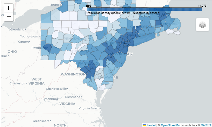
Establishing Spatial Frames: Rejecting vague narrative descriptions of territory, the book teaches how to establish rigorous boundary rules—using the "BosWash" megaregion as a primary case study—using explicit administrative codes (FIPS). This ensures analyses are reproducible and legally auditable.
Alignment and Identity Safety: The book addresses the critical risks inherent in joining diverse datasets. It teaches readers how to construct valid legal identifiers (GEOIDs) to prevent "silent corruption"—instances where data fails to align with actual territory due to formatting errors.
Coverage as a Non-Negotiable: enforcing a strict "Fail-Fast" discipline, the methodology rejects the dangerous practice of creating policy maps with invisible data holes, requiring immediate halts to analysis if jurisdiction coverage is incomplete.
Visualization as a Visual Contract
Moving from data engineering to the creation of evidence, the final sections argue that visualization must be treated as a "Visual Contract" with the public.
The book warns against the misuse of linear color scales that erase critical regional variations, instead mandating techniques like Quantile Classification to ensure visual honesty in presenting metrics like population density.
The volume concludes with a hands-on execution of the BosWash workflow. By completing this core project, the reader gains a reusable, auditable pipeline that produces not just a map, but a verified policy instrument capable of withstanding intense public and political scrutiny.
Geospatial Data Science for Politicians and Policy Makers: Volume I is available now for members seeking to elevate their data governance capabilities.

Comments